Native Americans were here before Explorers

La Montange Dans Le Atchafalaya
The ghosts of the past speak to all those that will listen.
In the Bayou Pigeon book, on page 481, in writing about the Berthelot family, I made mention of the fact, that I made my first trip to the La Montange with Mr. Dudley Berthelot. At the time, I did that to make a point of my personal connection to the Berthelot family. In hindsight, I realize, I failed to recognize and include in some way in another part of the book an important piece of Bayou Pigeon. That is... The Montange, itself!
La Montange is Cajun French for ‘The Mountain” (English), The Montange is a high mound area that looks completely out of place in the swamp. It looks out of place because it is a high ridge (i.e., a Mountain) at least Elevation 5 ft above the floor of the surrounding swamp. It is surrounded by cypress / tupelo swamp.
The Montange is located a distance off Big Bayou Pigeon, near Bayou Mallet, a stream in the Bayou Pigeon / Grand lake Vector. La Montange, is located in T 12 S R 11 E, Sec. 2. This site is isolated and very difficult to get to in low water. Its location is known mostly by only a few Bayou Pigeon folks, and mostly over the age of 55. The Montange has always been considered as a secret hunting spot by the locals. Because of its remoteness, difficulty to find and low water access it keeps all the ‘sports’ away.
After that first visit to the Montange, I never had the occasion to go back to the Montange, in low water. However, over the years my friends Anderson (Gut) Hebert and Johnny Johnson and I rode over it a few times in our crawfish skiffs (during the high water season) scouting places to put out crawfish traps. Johnny would always say, “That’s a real Indian mound, Chachie, once I found a real jawbone there”. I would typically reply something to the effect, “oh really” with Tongue firmly in cheek.
As I get older, I have convinced Johnny and Anderson that we needed to ensure that our sons know of our / these secret spots otherwise all the knowledge we have learned will be lost to history. The Montange is one of these things.
So, after some persuasion, I finally talked Johnny &Anderson into making a trip to the Montange in Low water, where we could really see it. We would borrow Darryl Berthelot’s, low water surface drive type boat and go get some pictures. After all, it had been over 40 years since I had been there in low water. No kidding, it really is hard to get there in low water.
Jim Delahoussaye – Naturalist
 |
Jim Delahoussaye |
Over the course of researching the Bayou Pigeon book, I discovered the writings of Mr. Jim Delahoussaye of Butte Larose, LA. He is a retired Water Solutions Biologist and he describes himself as a Naturalist. After reading some of his work on his blog, River Logue I quickly realized this was a man that knew stuff about the basin. I was impressed with Jim’s knowledge of the Atchafalaya Basin history, culture, folk life, fauna and critters.
So on a whim, I invited / asked him via e mail, if he wanted to come with me to the Montange. I explained it was high mound area and my friends said it was an Indian mound, but it was a secret spot and I just wanted to go there one more time. To my surprise he said yes. Well that was just the first of my surprises. Anyway, I sent him a screen shot from Goggle Earth Satellite imagery showing the approximate location and we set a date for the trip.
Jim met me and my friends at the Bayou Pigeon Boat launch, on 2-14-2014. He came in hand with some official research information about the site from Louisiana Archaeological records. I was stunned; you mean this site is officially listed as an Indian mound? Yes, the Montange is officially recorded as State archaeological site16IB8.
Can you believe it? Real life Native American sites / mounds at Bayou Pigeon.
After we completed the trip, I was rejuvenated on learning more about the Indian Mounds in The Atchafalaya, (It turns out Johnny Johnson was more right than I thought). I went back and read again a lot of the reference information I had archived from writing the book. Listed below is what I learned.
Archaeological Sites in the Atchafalaya Basin

At the time of this writing I have found out there are 71 recorded archaeological sites in the Atchafalaya Basin Floodway System.
Most of the early (1913 – 1937) archaeological visits to these sites in the basin were done by Archaeologists for traditional reasons, i.e., to investigate and preserve clues of former cultures in order for us to understand our link to the past.
In the fall of 1912 and spring of 1913, the first reported archaeological investigation in the Atchafalaya Basin was conducted by Clarence B. Moore. Sponsored by the Academy of Natural Sciences of Philadelphia, Moore visited various lakes and bayous associated with the Atchafalaya River. His study area extended from the Red River south to Morgan City and included the parishes of St. Landry, Iberville, St. Martin, Iberia, and Assumption (Moore 1913:9-10
The next notable archaeological research in the Atchafalaya Basin was conducted by Fred B. Kniffen. In 1937, Kniffen visited sites within Iberville Parish and, to a lesser extent, Pointe Coupee and St. Martin Parishes (Kniffen 1938:190
Since the 1950’s the visits appear to be mostly part of the US Corps of Engineers cultural resources management program, e.g., mandatory Investigations which are conducted prior to start of any Corps of Engineers flood control construction.
Landscape Features of the recorded Archeological sites in the Atchafalaya Basin
Shell Middens are the most common features at the prehistoric sites in the Atchafalaya Basin. Most middens are composed predominantly of Marsh Clams (rangia cuneata).
Earth Mounds are not as frequently reported as the shell middens, but that maybe because of a lack of data / documentation versus the actual scarcity of the mounds. I suppose archaeologist think that shell middens got more notice and plain dirt mounds may have been overlooked. The earth mounds seem to occur predominantly in the Northern portion of the Basin, above i.e., above Hwy 190 and shell mounds more in the southern portion.
The Naming Convention used for the sites are:
First two numbers: 16 = Louisiana
Middle two letters: = Parish, e.g., IB = Iberia, IV = Iberville, SM = Saint Martin
Number: = numerical order
From published Corp of Engineers reports I have identified at least 15 recorded sites in the Bayou Pigeon_/ Grand Lake vector of the floodway.
About the Bayou Pigeon / Grand Lake vector
The Bayou Pigeon / Grand Lake vector is relevant because I intend to limit future post about any archaeological sites in the Atchafalaya Basin to that vector. Why? Because it is our area, part of our Bayou Pigeon history.What is the Bayou Pigeon Grand Lake vector?
First, what is a Vector? In Geographical context it is a quantity having direction as well as magnitude, especially as determining the position of one point relative to another.This is important in because Vector’s were recognized long ago by the Swampers of the Atchafalaya. How is that? Cajun / Swamp Custom holds that if you hunt or fish a certain area, first, you have the clear-cut ‘folk right’ to defend it from other fishermen / hunters coming in on top of you. Thus today's mapping vectors in the Atchafalaya have long been recognized as the natural boundaries of the Fishing and Hunting areas of a community/s. Eg. Bayou Pigeon community equal Bayou Pigeon Grand Lake vector.. This holds true throughout the Atchafalaya basin. For example, Bayou Sorrel is Vector A06, Butte Larose, Catahoula Henderson is A07, and Belle River /Pierre Part is A09.

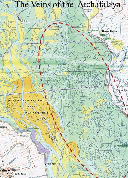
2004 Imagery of hundreds of miles of man-made canals (i.e., all straight lines are Man-Made made) Bayou Pigeon, Belle River, Grand Lake Vector.
Listed below are the recorded sites that I have identified in the Bayou Pigeon / Grand Lake vector.

The Trip to the La Montange:
The route to the Montange is via a swamp slough. The site is located on Big Bayou Pigeon. The exact location of The Montange is not given so as to protect it from unauthorized artifact seekers and vandals. Please note La Montange is located on private property. It is against State law to remove artifacts from any archaeological site without authorization.

The trip resulted in the identification several pieces pottery shards and measurements of the approximate size of the shell midden and identification of shells on the mound. We used the format of the state archaeological records to record the info. Our results / info below, it will be used to update official site records.

Bayou Plaquemine Distributary System
Big Bayou Pigeon is considered part of the Bayou Plaquemine Distributary System. The prehistoric archaeological deposits of the Bayou Plaquemine Distributary System consist mostly of Rangia shell middens in a linear pattern along the natural levees of major waterways. Earth mounds are also located primarily on the natural levees of the distributaries of this system.The known archaeological sites associated with the Bayou Plaquemine Distributary System have been greatly impacted by natural processes, i.e., buried and / or partially covered up by sedimentation in the last 100 years.
The Montange, because of its location has not been affected as much as other site sin the area that are located on major waterway carrying heavy sedimentation during flood season.
Why is that? The Montange may be located on old abandoned distributary between Little Bayou Pigeon and Big Bayou Pigeon.This would explain why it has been somewhat preserved from heavy sedimentation and why it seems to be out of place in the middle of the swamp.
The highest probability for finding artifacts are on archaeological sites in the Atchafalaya basin that are on the natural levees of extinct and extant distributaries in and around the basin
Who were the people to use this mound?
Site 16IB8 ( La Montage) exhibits pre historic Coles Creek culture and Plaquemines culture.
What are Coles Creek and Plaquemines culture?
The Coles Creek culture is the name given to sites created by a group of pottery-making Native Americans in Arkansas, Louisiana, Oklahoma and Texas, ca. AD 400 to 1100, ie, the designation prehistoric sites. The Plaquemine Culture (1100 to 1730) (Neuman and Servello 1976:19), developed out of Coles Creek in the Lower Mississippi Valley.
Note; The Chitimacha Indians of Louisiana probably developed out of this culture. Most assemblages from the Atchafalaya Basin are representative of the Plaquemine Culture.

The cultural deposits were first recorded by Kniffen in 1937, are representative of the Coles Creek / Plaquemine period thus the Montange is likely associated with this time period, ie, up to the 1700’s of Louisiana history.


The Coles Creek / Plaquemines culture / people collected wild seeds, fruit, roots and other plant foods. They hunted but mostly fished to survive. Fish was their primary source of food. At the time of Columbus’ discovery of America, historians estimate the combined strength of the Indians in Plaquemines Culture groups was about 20,000.

The probability of discovering any new / newer archelogical sites is greatly lessened today due to the high sediment rate within the basin proper. This is why documenting and preserving the site 16IB8 The Mon_tan is important to history.
In the 1600’s and 1700’s there were three Indian tribes that were documented as having migrated through and/or having lived within the Atchafalaya Basin. They were the Chitimacha, the Houma (Gibson 1982:88-89), and the Bayou Goula (Manning et al. 1987:30). Sometime before the 1700s, the Chitimacha’s moved north from the southern portion of the basin to Bayou Plaquemine area (Manning et al. 1987:3 1). Between the years 1706–18, the Chitimacha engaged in a long, bitter war with the French. The result was that the eastern Chitimacha were nearly wiped out. Those who survived were forced out by the European settlements. By 1730 they moved across the basin to the western branch of the Chitimacha Lakes (now Grand Lake) and along Bayou Teche (Gibson 1982:86
The existence of the Montange ,Site 16IB, suggest that Bayou Pigeon could have been an east-west water route for the middle of the basin, use by the Chitimacha joining the Grand Lake village sites to villages along Bayou Plaquemine / Grosse Tete area.
On the Montange 2 14 2014 - Master Outfitter / Guide/ Swamper Anderson Hebert of Bayou Pigeon

Lloyd Hebert & Jim Delahoussaye on the Montange 2-14-2014 at the shell midden area

Chachie & Jim on the Montange 2- 14 - 2014

Jim looking for artifacts

Shells and Pottery shards 2-14-2014

 |
Pottery shards and shells on the north end of Mon_Tan 16IB8. Shards with lines are more significant than those without markings. Note/fact: There are NO rocks in swamp sediment. The fact that the shards are there and the markings on them are not random are objective evidence that man put them there. Over 1,00 years old!!! |


La Montange - in the middle
In Conclusion:
The Atchafalaya Basin Floodway has experienced progressive basin wide vertical sedimentation for thousands of years and continues to do so. It is a natural process. However, accelerated sedimentation of caused by man made activities in the last 100 years has greatly affected these pre historic sites, as evidenced by the historic filling of the Lake Chicot/ Grand Lake / Six mile system. In addition the activies of man have scattered modern debris across some the sites, because they were high ridge areas conducive to living in the swamp.
La Montange is not in immediate danger of being buried by immediate vertical accretion of sediment, but it is obviously on a path for that to happen. So far, the location, e.g., difficulty of access has protected the Montange from human debris scatter.
Thus it is important for us to document its existence and preserve it as long as we can. We pray that this blog post will be a little part of doing that.

In “Bayou Pigeon Spirit of the Atchafalaya”
From Cliff (Chachie) LeGrange, Anderson (Gut) Hebert, Johnny (Jeremiah) Johnson, T-Lloyd Hebert and Jim Delahoussaye…
Enjoy!
 |
Chachie and Jim Delahoussaye with a Cypress Drift on Mon_Tan - February 19, 2014 |
References:
The Louisiana and Arkansas Expeditions of Clarence Bloomfield Moore. Edited and With an Introduction by Richard A. Weinstein, David B. Kelley, and Joe W. Saunders. (Tuscaloosa: University Of Alabama Press, 2004. Pp. Ix, 676.
US Army Corps of Engineers, New Orleans District;
Historic Properties Management Plan for the Atchafalaya Basin floodway System Project, South Louisiana
Remote-sensing Survey of the Atchafalaya Basin Main Channel, Atchafalaya Channel Training Project, Sts. Martin and Mary Parishes, Louisiana; Cultural Resources Series
Il Report Number: Coelmn/Pd-90/11
Gemorphical Investigation of The Atchafalaya Basin, Technical Report Gl-63-3, Us Army Waterways Experiment Station
Phase I Cultural Resources Survey and Archeological Inventory of the Bayou Sorrel Lock Replacement Project Iberville Parish, Louisiana, Corp of Engineers,
Cultural Resources Survey of EABPL Offsite Borrow Areas, Levee Items E64 E76 and E84a Iberville Iberia and Assumption Parishes
Timothy M. Schilling
B.A., Louisiana State University, 2002
May 2004; Excavations at the Bayou Grande Cheniere mounds (16pl159): a Coles Creek period mound complex
Chachie --I think your research is impeccable and the write up is great. Who would have thought 5+ years ago when we started the Bayou Pigeon book project, that we would come to learn of a small mountain and quite possibly an Indian burial ground right in our backyard swamp. All of us, who lived in Bayou Pigeon in the very early years, can remember the older guys recounting stories of strange and mysterious sightings and happenings in the Atchafalaya. Who knows maybe there is some Indian ghost floating around the Atchafalaya!
ReplyDeleteThanks for the kind words...maybe you will write something for the blog ...
Deletemy uncle lived atop the mound in gibson,la!
ReplyDeleteI come across a few sites not listed while hunting in the basin. I have seen shards an shells, this explains a lot. I never remove any of it and leave it so my Grandkids can see a glempse into the past. Ill never tell where it is.
ReplyDelete