Monday, September 18, 2017

October is Atchafalaya month, Celebrate the Atchafalaya


ATCHAFALAYA MONTH

Whereas, the Atchafalaya National Heritage Area is one of 49 nationally distinctive heritage areas designated by the United States Congress;

Whereas, the Atchafalaya National Heritage Area contains the Atchafalaya Basin, the largest river swamp in America;

Whereas, the Atchafalaya National Heritage Area encompasses 14 parishes reflecting the unique culture evolving from life in the Atchafalaya Basin;

Whereas, the Atchafalaya Basin is considered the most productive swamp in the world and contributes substantially to the economy of Louisiana;

Whereas, the Atchafalaya Basin houses important wetlands that serve as buffers during storm surges;

Whereas, the Atchafalaya National Heritage Area offers exceptional opportunities for education and recreation;

Whereas the Atchafalaya National Heritage Area encourages and promote recreational and educational activities during October to raise awareness of the valuable resources located within the Area;

Therefore, we do hereby proclaim October 2017,  Celebrate the Atchafalaya month.

Know  Atchafalaya  Heritage


The Atchafalaya Basin is Part of the Mississippi River Geomorphology


The Atchafalaya River Basin lies at the very bottom of the Mississippi Watershed. The Atchafalaya River Basin is a sub component of the Mississippi Alluvial Valley
(MAV) ecosystem


Geomorphology is the study of landforms, their processes, form, and sediments at the surface of the Earth.  River basin s have a particularly geomorphology, Tributaries, Alluvial Valley, Deltaic plain and a receiving basin.  Just remember, water runs downhill and you will be alright.

The Mississippi River, with its sand and silt, has created most of Louisiana. The Mississippi floodplain is more than 100 miles wide. The Atchafalaya Basin lies at the very bottom of the Mississippi Watershed. It is part of the Mississippi’s lower river deltaic plain.


Located in south-central Louisiana, the Atchafalaya River Basin extends from the confluence of the Mississippi, Red and Atchafalaya rivers, near Simmesport, to the Gulf of Mexico near Morgan City. Situated in the heart of this natural basin is the 833,000-acre Atchafalaya Basin Floodway. The floodway is about 15 miles wide and confined by the East and West Atchafalaya Basin Protection levees.


Location Of  Atchafalaya  Basin


Limits of Geomorphic Atchafalaya Basin


Natural Atchafalaya Basin to the Atchafalaya Natural Heritage Area
- Atchafalaya Floodway to Natural Atchafalaya Basin


Atchafalaya National Heritage Area to Atchafalaya Floodway


The Atchafalaya Basin is the largest contiguous wetland and swamp in the United States. Located in south-central Louisiana, it is a combination of wetlands and river delta area where the Atchafalaya River and the Gulf of Mexico converge.

Pronunciations

Officially, the State of Louisiana pronounces Atchafalaya – (ah-chafa-laya) It is the English version of a Choctaw Indian word “hacha falaia,” which means long river.

The pronunciation of Atchafalaya is somewhat troublesome because it is the French spelling of an Indian word. In French "ch" is pronounced as "sh" is in English. Thus "tch" is used in French to denote the English "ch" sound. Therefore, some linguist say correct pronunciation of Atchafalaya is as though it were spelled "acha falaya.“


The Atchafalaya Basin is one of the nation’s last great river swamps. It is also a principle floodway of the Mississippi River and Tributaries Project. The New Orleans District, U.S. Army Corps of Engineers, maintains 449 miles of federal levees, 14 pumping stations, 15 drainage structures and four navigation locks.  Their job is overseeing the basin and ensure it is able to remove flood waters and keep basin channels open for commercial barges and small boats.

Know the Heritage …

The Atchafalaya Basin is a term that is used in multiple contexts, a Natural Wetland Basin, a Floodway, and a Cultural Heritage Area.


Friday, February 17, 2017

How did the Cajuns find Pierre Part ?

How did the Cajuns get to Pierre Part?


Just, how did the Cajuns get to Pierre Part?

Since most people know the Cajuns are descendants of Acadians from Nova Scotia, and the story of the 'Grand Derangement' and how 2500 Acadians from Acadia came to Louisiana.

But that does not answer the questions of the inquiring mind, how did a lot of those Cajuns end up in Pierre Part?

Here's the rest of the story:

The very first Acadians to arrive in the Louisiana territory consisted of 21 people in 4 families. 

They came in 1763, and settled on the west bank of the Mississippi in "the area of the vacant lands between [Nicolas] Verret's Plantation and [Jacques] Jacquelin's Cow Ranch," near the present site of Lagan, St. James Parish.  Here they created a little Nouvelle-Acadie of their own called The First Acadian Coast.   This settlement preceded the Bayou Teche Cajun settlement by at least one year.

More Acadians began to arrive in 1765 /1766, most were settled above present-day Donaldsonville, on Bayou Lafourche, in Ascension Parish.   This area was called the "Second Acadian Coast".  

In 1765 the Spanish Governor of Louisiana who wanted to increase beef to New Orleans and upon learning that one group of Acadians just arriving in Louisiana were known as Cattle farmers sent them to the Bayou Teche region, which was known in pre-Acadian days as cattle country, ie., grass prairies.


Thus, the beginning of so-called Prairie Cajuns and eventual formation of four different Cajun subcultures based on the environment they lived in.

For this story we are concerned with what has become known as Bayou Cajuns.

 A third Acadian coast was “The Maryland Acadians,” who settled at St. Gabriel, Iberville Parish in 1785.

The Acadian Coasts are not "coasts" as one would think of the term today as land along the seashore of an ocean.  

A coast by definition is "the land near the shore "but in this case, the shore is the land along the Mississippi River.

During the 18th and 19th century Louisiana the term coast was used to describe the distinct settlements situated just above New Orleans along the Mississippi River's edge. There are naturally two coasts. The left coast or left bank was the land located on your left-hand side if traveling down river, the east bank, and the right coast or right bank was the land located on your right-hand side if traveling down river, the west bank.  “The Coasts,” in this context are named for the first settlers to establish along their shores, ie., Acadian Coast and German Coasts


In August 1770, a Spanish census …of the Acadian settlers in the district, (1 st & 2 nd)  Acadian  Coast) and counted 84 families.  In 1777… the Spanish governor counted… 61 men, 67 women, 128 boys… 92 girls, 1,178 horned cattle, 158 horses, 80 sheep, 882 swine, 130 arms, 1 free savage, 12 goats, and 3 kid's.

These new settlers were called 'Les petits habitants' French for Small Farmers.


The Cajuns brought with them to Louisiana many skills, including all aspects of farming. Carpentry was one of them, fencing for the farm was important.  

The Cajuns had two kinds of pieux fences, and both are depicted in the sketch.  One was of vertical boards, and it could be a small picket fence around the house, are a very tall one around a vegetable garden (to keep out chickens).  The other pieux fence had pieux boards driven into the ground, and holes were dug into them (often with a special froe).  Then horizontal pieux were placed in the holes, as seen around the field near the house. Explanatory note: A pieux is a board.  The earliest were hand rived of cypress.

Louisiana Purchase 1803

After the new USA completed the Louisiana Purchase, new American immigrants, began to move into the area. These Americans had money to spend on land, and they began to push / buy out the small and poor Acadian farmers, “Les petits habitants" from the good front lands along the Mississippi River and Bayou Lafourche. 

The Bayou Lafourche Acadians did not to resist these new immigrants too much, they hated debt.
The Americans were willing to pay a good price to the Acadians for their small farms and they distrusted the new Anglo (English speaking) government. After Grand derangement they distrusted any government, much less English speaking!  

Instead of taking the money and moving or looking for better ground to the north or to the Bayou Teche area, the Lafourche Basin Acadians would fall back closer to the east edge of the Atchafalaya Swamp, the 'interior' as it was called. 

This was documented by Pitot, James (Pacques-françois), Spanish Cabildo Ward Commissioner of New Orleans; 1802 -1804. He wrote a critique of Spanish rule of Louisiana colony - 1796 to 1802 for the French who had taken over from the Spanish.  This was before the Louisiana Purchase.

He observed that La-fourche Parish was already enjoying an increased rate of growth. His description of the region reveals the changing complexion of Acadian coast settlement along Bayou Lafourche, as English-speaking planters began to move into the region the 'Les petits habitants' withdrew into the further reaches of the swamps”.  

The Les petits habitants recognized there was some opportunity for agriculture in interior, along the narrow strips of ridge lands along the Bayous. 

Leading to the south and west of Bayou Lafourche several smaller bayous provided ingress to areas around Lake Verret, Grand River and Lake Palourde.

The Acadian “les petits habitants” displaced by the plantation system followed two migratory patterns. 

1. From the Upper Lafourche Valley to the Atchafalaya interior, i.e.., Pierre Part, Belle River, i.e.., the Lower Grand River area, 4 Mile Bayou and Bayou Boeuf.  

2. The Lower Lafourche Valley, to Paincourtville, Napoleonville, Houma, and Raceland area.

The Route to Pierre Part. 

At the Village of Port Barrow on the banks of Bayou Lafourche slightly below Donalsonville, there was a cordelle road / path, it was along, a small slough, to the source of Grand Bayou, which led to Lake Verret. 

By 1815 a small settlement of families, existed on the west banks of Lake Verret, where Bayou Pierre Part flows into the Lake Verret. 

Other settlements were placed on the *brules, surrounded by swamp, Brusly St. Vincent, Brusly St. Martin.  Brules’ were high natural ridges cleared and burned… ‘brules” French ‘for burnt’. 

Between 1780 and 1803 the Atakapa's Canal (pronounced tack-a-paw) was completed, i.e.., a man-made canal made by extending a natural bayou that was connected to Lake Verret with Bayou Lafourche.  

This route also provided a shorter route to the lower Atchafalaya Basin, i.e.., Morgan City and thus through Morgan City a faster route to the area of Bayou Teche rather than traveling the Mississippi River to Bayou Plaquemine, then west across the vast Atchafalaya Swamp.  Where navigation was continuously hindered by log rafts / jams which moved around in the annual flood pulse.


Commercial Agriculture

Pierre Part / Belle River continued to grow because there was some opportunity for commercial agriculture along the narrow strips of ridge lands along lower Grand River. Several large Commercial sugar plantations were started by several successful Acadian planters from Upper Bayou Lafourche.

Florentine Michel and Company 

Florentine Michel acquired land on the shores of Belle Riviere and built a sugar plantation that became known as “Florentine Michel and Company,” which was to become the Grand Riviere Plantation.  Florentine built the Grand Riviere Plantation into a successful enterprise and sold it in 1848 for $17,000. He left Belle Riviere and moved back to Bayou Lafourche Basin. 

Florentine Michel and his wife, Marguerite Arthemise Theriot were married 2 February 1819 and had seven children: Pierre Florentine Michel, Jr., 1819; Francoise Michel, 1821; Delphin Michel, 1823; Joseph Justilien Michel, 1827; Marie Angelina Michel, 1830; Paul Elphage Michel, 1833; and Marie Michel, 1835. When Florentine Michel died on Sept. 20, 1855, he left each of children an inheritance of $2,311.29. 

Adélard Rousseau ( a French Creole) also owned a successful plantation, Belle River.  (Source; Mr. Wildy Templet book).

Joseph (Justinien/Justilien) Michel, son of Florentine was born near Convent, St. James Parish, in June 1827, he married Marguerite Azella, daughter of French Creole Adélard Rousseau, at St. Elizabeth Catholic Church in Paincourtville, Assumption Parish, in July 1848. 

Justilien Michel formed a sugar Plantation at Bayou Pigeon in 1857.

'Petits Habitats De Marecage'

It was not long however before the vast majority Acadians Petite Habitants recognized the vast natural resources that existed in the Atchafalaya River Basin were easier to harvest than eking out a living farming.  

Thus, they turned their livelihood to the swamps. By 1820 they were shifting their living from subsistence farming to fishing, trapping, hunting, moss picking, and logging cypress trees.  

They came to be called 'Petits Habitats De Marecage', Farmers of the Swamp. 

Because of the isolation and ruggedness of the Atchafalaya Swamp the Cajuns on the eastern side of the Atchafalaya swamp became semi- isolated from the new Americans and even their cousins living on the levee lands along Bayou Lafourche. 

Thus, the beginning of what we know of today as 'Bayou Cajuns'.

They did not intermarry with other ethnic groups, for several generations therefore Pierre part, Belle River Lake Verrett communities maintained the traditional French Acadian culture and language much longer than their cousins. 

Today, Pierre Part has maintained better than most past Cajun communities the Cajun Language. 

It is one of the last small pockets of Cajun French speaking communities on the eastern side of the Atchafalaya Basin.

Preserve the Heritage...


Enjoy...

Selected  Reference :

Bergeron, Maida Owens, "Language Maintenance and Shift in a Bayou Community." (1978). LSU Historical Dissertations and Theses. 8174. 
https://digitalcommons.lsu.edu/gradschool_disstheses/8174

Wednesday, July 27, 2016

Here’s your sign ;

Here’s your sign ; 


This Blog posting  is  about SIGNS….  in the  Atchafalaya Basin/ Floodway  . 

For the record, polls / surveys  reveal that most people view signs  in scenic places as intrusive and that they  take  away  from the natural visual environment and beauty of the outdoors…

With that said that said  I do realize there are many legitimate  reasons  for  signs and  some are absolutely necessary ie., ‘Warning Signs ‘calling  attention  to an unexpected  waterway condition / obstruction.  

And  sometimes…if you see a  sign  it means  "Hey, buddy, you're were not here first,  somebody was  here before you , ie.,  meme,  ‘Kilroy was here’

In some cases signs, done skillfully have a great potential in contributing to the sense of  importance  / history  about a place, ie., historical markers.

The  stimulus  for this  blog post… is that I  have been noticing a lot of signs showing  up  in the Bayou Pigeon / Grand  / Lake Vector  of the Atchafalaya  Basin these days.  If you travel the Basin  from  the Bayou Pigeon public  boat launch… in the  main bayous you've probably noticed  this as well.  At times, it seems  you can see a  sign  at anytime  in your visual line of  sight.  It  makes you wonder, are all these signs  really necessary ?  

Are they  helpful, or  do they reduce the visual environment of the Atchafalaya swamp?  

I’ll let  you the readers decide  for yourself.

Thus this little history about / on signs in our area  of the  Atchafalaya  Basin 

Landowner  / Property signs 


Prior  to the 1940’s  / 50’s there were just a few signs   relative to trespassing  and  land  ownership, in the basin.  A tradition of tolerance  had developed among the landowners  for  the Swampers regarding  fishing, hunting  and trapping. Basically a  culture  had developed  in the early 1900’s  that  the landowners  allowed Swampers   to hunt, fish and trap fur wherever  they found  fish and  game . This  was primarily because the area was  isolated  and the Swampers lived on houseboats versus the land and they moved  around a lot…, ie. they were not long term Squatters. 

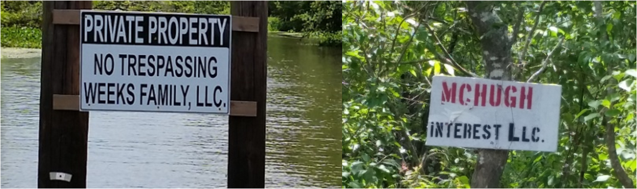
Most  Atchafalaya  Basin landowners  have always had signs  stating posted  / no trespassing  marking their property lines.   What does the posting of No Trespassing signs accomplish?  "Protection from Property Liability“.  Law Code requires that land owners post conspicuous signs near the primary entry points of the area that  are closed to the public.  In the  Atchafalaya  Basin they are typically small and  strategically placed.   When the signs are  high quality and well maintained  the landowners credibility  / professionalism is enhanced.


Williams Inc. – 


The  company internet web site  says, ‘Williams inc. is a privately  held company which has been operating in Louisiana since 1935. It is the successor to the F. B. Williams Lumber Company and its affiliates which began operations in 1872. Williams, Inc. and its affiliates currently manage over 85,000 acres of land located in 13 parishes in South Louisiana. The company has continued a tradition of protecting and enhancing the value of its properties by prudent and responsible management. There lands are managed as a renewable resource and some of our hunting and campsite lessees have been with us for generations.”  

My  experiences  are, with Williams Inc. that they are professional and  keep  their property lines clean, clearly visible and unobtrusive.  . Why  do I say that?  They use small, long lasting metal signs , attached  with minimum nails, ( 2, Galvanized), strategically located  for long term sustainability.  Property  corners highlighted by blue paint  at the start  and  show  the N/S, E/W  direction… of the line. Periodically on  heavily  traveled  Oil & Gas  access canals  they will have larger signs marking their property line. 


Jeanerette  Lumber - Robert Henry Downman:

A name most  folks in  Atchafalaya  Heritage  are not familiar  with.  I don’t  understand why, he was  listed as  one of  the 100 Eminent Lumbermen of the United States.  Mr. Downman  controlled the Jeanerette Lumber & Shingle Company, Limited, at Jeanerette, Louisiana;  the Bowie Lumber Company, Limited ; the Des Allemands Lumber Company,  The Iberia Cypress Company and the White castle Lumber & Shingle Company. “ He  was as well known  and prolific   ine the Cypress  Timber business as F.B. Williams,  who was called ‘The Cypress King” of but  he was of  a lower profile. 

My  experiences  with Jeanerette  are  similar to Williams  inc. Their property lines are marked and current. They use small, long lasting metal signs , attached  with minimum nails, ( 2, Galvanized), strategically located  for long term sustainability.  Property  corners highlighted by yellow paint  at the start  and  show  the N/S, E/W  direction… Many Oil & Gas  access canals   have there names  listed as well.


Brownell  Land Co.

The Brownell Land Company is the 21st century legacy of the Brownell family in Louisiana beginning in 1880. 

The Berwick Lumber Company consisted of a lumber and shingles mill in Berwick City, Louisiana, Charles Horace Brownell, (1865-1934) son of Charles Richard Brownell, managed the latter. Charles Russell Brownell Sr. and his wife, Anna Widmer  had one son, Dr. Charles Russell Brownell Jr.  Like his father Brownell Jr.  Managed  family business, while  also engaging in a medical practice and politics.

He was mayor of Morgan City from 1951 to 1983 and served for the State House of Representatives from 1948 to 1952. The Brownell family is known  for participation in philanthropic activities and charities. 

The  company owns land in St. Martin, St. Mary, Terrebonne, Iberia, Assumption, and Iberville Parishes. Is a  major landowner  in the Atchafalaya  Basin.

The CEO, Michael Vanover, is the son of Dr. Charles Russell Brownell Jr. and took over when Dr Brownell passed in 1989. 

My  experiences  with Brownell Land  Co.  are very positive.  they have  strong  connections with the  'Folks'  in the Atchafalaya  Heritage parishes.  They view their lessee's as  assets  and depend on them to be there eyes and ears on the property.   Mike Vanover personally makes a once year  trip through their entire landholdings.


Kyle  Peterman Management  Corp.

Is the is the descendant of the  Kyle  Lumber Co which was established in 1866.

Kyle  Lumber Company consisted of a lumber and shingles mill in Franklin, Louisiana.  Today Kyle Peterman manages  over 20,000 acres in the  Atchafalaya  Heritage  area.

Newman  Trowbridge  Jr.,  who died in a  scuba  diving  accident in 2014, was the long time  leader of  K-P Management from the early 1970's .  In my opinion, he was the  single most important person in representing Louisiana  Atchafalaya  Landowners interest in preserving  private property and at  the same time accommodating a multi use strategy to sustain / preserve the Atchafalaya Basin.

Making the  Atchafalaya a  National Park / Preserve  and closing down the land to everyone but hikers and birdwatchers is and was not a popular plan with local folks.


A. Wilbert's  sons LLC 


Located in Plaquemine, La.  has been around  since  1848.  Today they own  thousands of  acres of land in 10 Louisiana parishes located in  the  Atchafalaya heritage  area.

A. wilberts has played a  large role in preservation  of  Atchafalaya  Basin wetlands and community projects in  Iberville Parish and to the  community of  Bayou Pigeon, LA.

They maintain posted / no trespassing signs on the major bayous.


Small  Landowners:


There  are many  smaller  land companies  located in the Grand  River -  Bayou Pigeon  vector of the Atchafalaya  Floodway.


State  Lands:


The  state of Louisiana  owns thousands of  acres in the  Atchafalaya  Floodway as  well… The  Dow Chemical  Co.  donated  50,000 acres of land  to the  state in the 1970's. (the old  Schwing  Lumber co.)  They put signs  on their property as well.  There signs  are  sometimes questionable because they put  up signs on disputed  property that are  claimed by private  landowners as well.  


Oil & Gas  Industry 'Signs"


The 1940’s  saw the beginning of Oil & Gas industry in the  Atchafalaya  Basin Floodway. Throughout the 1950’s and 60’s access canal were dredged through the  swamp, Oil Wells  drilled, production facilities  and docks  constructed.  Thousands of miles of pipeline canals dredged and pipe laid.  Facilitating a  whole new era of  Swamp  signs…

Hunting Club  Signs


Starting in the late 1970’s leases  for hunting rights  began appearing in the  Atchafalaya Basin…particularly  in the Grand Lake / Bayou Pigeon vector.   Tradition and culture  since 1900’s  had developed,  that people hunted, trapped and fished where they wanted.  The Landowners  tolerated  that trespass. Even though the landowners  already had  property signs hunting  Clubs  add there own  signs.

Today it seems every inch bayou frontage is leased… Hunting club  signs are everywhere, in some cases it seems every 100 yards … and  they are made out of every  conceivable  type of material… from  plywood,  55 gal. drum lids, 5 gal bucket tops, vinyl siding, waterproof coated paper, metal , and corrugated plastic.

Recently, at the boat launch someone asked a  sport fisherman, where he caught his fish  and  he said … you know on Turkey Bayou…this guy  had no idea  where Turkey Bayou is , all he knew  there was lot of  signs  that said  Turkey Bayou…

Posted signs are just like locks,they keep good people honest…  not Outlaws.


Signs are nailed to trees, pilings,  platforms… it doesn't matter…


Memorials, Historic  Markers & Swamp Graffiti


Our Lady of the Atchafalaya
Through Your Intercession Guide all who View, Fish and Hunt , safely  through these  waters. Protect  from Unseen Logs, Stumps, Tree Limbs, Pilings and Outlaws.
Keep the Waters Clean and Swift, the  Sky Clear, that all God's Species can Swim, Jump and Fly…
God Bless our  Swamp


It seems good to mark and to remember for a little while, the place where a man died.


Not every graffiti writer is equally skilled at their task, some  are better than others… 
these guys have some creative  ability.. 


High Water Marks / Records


I consider this high water marker put up by  Alex Settoon and his daughter (Kim) in 1973  to be an Historic Marker…even though it is not your  typical state  sponsored  historical marker…it is hallowed  ground ... viewed by thousands of people since it was put up...


In 2011 original sign refurbished… and another new marker  for 2011 put up  by same daughter,  Kim Settoon Leblanc


It seems  as if  everyone wanted to get in on a sign... new  high water marks on Grand  Lake  and  Reed Canal...


Sometimes you have to mark the trail / path  for some people...

In conclusion...


The best way to preserve our history / culture / folklife is to teach it to them...and tell them to pass it on to future generations...

“I do love a good sign… Signs tell the rules, and rules keep everyone happy.”  however  when there are too many signs they become ignored…


Enjoy !

Monday, April 18, 2016

Those Damn Otters...

Those Damn Otters ;  Always Eating Our Crawfish

River otters have been causing havoc  in our Crawfish  Traps


Otters are part of the same family of animals as weasels, badgers. They have streamlined bodies that allow them to be excellent swimmers. They weigh between 11-30 pounds with the males weighing more than the females and up to 4 feet in length. Otters are dark brown with paler brown bellies. They have small eyes and ears and long tails. Their ears and noses have adapted to keep water out with valves that close when they are underwater. Otters have very noticeable whiskers that are long and white. 

Otters  are carnivores and capable of eating up to 2.5  pounds of  meat a day. 
Fish and Crawfish  are their  favorite  foods


In the  Atchafalaya  Basin, a wild otter diets varies according to what time of year it is  and what  happens to be available in the region.  While Fish  would seem to top the list most of the time.. . And Otters are very capable of catching fish anytime. 


Guess  what is  most available  in the  Atchafalaya  Basin… from March to  July… CRAWFISH…


Carlton  LeGrange holding a crawfish trap that has  been run by Mr. Otter.  Note  how it is opened  so perfectly on the trap door end. 


Since  two flue  traps  are usually set a 30 to 45 degree angle and / are leaned  up against tree with the point of the trap between the flutes touching the bottom.  Thus, the otter has a clean shot  at the back of the trap. Making it easier  for Mr. Otter.

An otter can dive  and open a crawfish trap perfectly  everytime.  I mean It is  always a  perfect  opening like the one shown. They are  professional… ie., they do it  with  speed and accuracy… better than a human…L.O.L. 

Old time  fishermen  tell me  Otters  have been known  to 'camp out'  on a crawfish trap line.  This is pretty common in crawfish  ponds, (ie., Rice fields), but in  the  Atchafalaya  Swamp  with deep water pillow type traps it is amazing.  In our case they went  right down the trap line. They, ( I assume  there  was a whole family of them)  ran hundreds of traps… I mean they did not miss one, it was uncanny.  They followed  every twist and turn  of the trap line, perfect.  

The direct loss of  the crawfish ,  the bait expense and the wasted time to reset the traps  can add up to hundreds of dollars in damages. 

Because of their status as “furbearers,” there are certain guidelines that  must be followed when dealing with these animals.  You can only take them legally in trapping  season  and  you must buy a $25 trapping license if you plan to sell the hides of the animals you catch. Trapping season runs November until March 31 each year.  If you have a problem in April, you can only live trap them legally.

Otters are much more difficult to trap than  mink, raccoon and nutria. Otters can dive as far down as 55 feet! They can also swim a 1/4 mile with only 1 breath and can stay underwater for 2 minutes.
  
I have been told they are only two immediate solutions to otters  running your traps. One solution is to sew a open end nylon webbing (similar to frog net)  into trap opening at the dumping  end of the crawfish trap . (Must be done during trapping season).  That way the otter swims through the mesh webbing, gets inside  the trap  and gets the crawfish  and then is unable to get back through the nylon mesh, and thus drowns.


Another , less  lethal  solution, is to lace a straight wire , about 1/8” dia. Over & under through the ¾ mesh wire ie.,  the trap door  opening.  This solution  takes a  little extra time  running the trap, but the otter usually cannot pull wire through.


Fortunately, Otters running your crawfish traps in the Atchafalaya  Swamp, ie.,   in deep water traps,  is typically an early spring  kinda thing.  The longer into season and  when you start catching several pounds of crawfish per trap, they usually move on. 

It’s a  good thing, because I was thinking , I  just might have to  do some outlawing wild Otter… just kidding !  


Like the  U.S. Marines, Savvy  Cajun Craw-fishermen  learn to Adapt, Improvise, and Overcome !

Preserve the  Heritage !